This is an archival copy of my PhD blog, which was active between 2009–2015. I'm publishing it again as a personal time capsule, but also because I think it's an interesting documentation of the PhD process itself, which might be useful to someone, somewhere. – Chris Marmo, January 2026

Personal Geographies and Constructed Histories

One of the research activities I conducted with Parks Victoria involved a mobile diary study. There are a couple of great introductions to the topic if you’re interested, but broadly; diary studies are a way of having participants reveal their daily practices through guided self-reporting. Mobile diary studies do this through the use of a mobile phone. The benefits of this: users typically already have a device, and these can be used to prompt participants for insights on their activites, real-time photos, etc.

In the context of my research, I opted to use a mobile diary study in order to gain an understanding of the practices of Park Rangers in relation to the places they manage. A mobile diary study seemed great for this as it allowed people to make entries whilst in the park itself – using the places and locations they work in and travel through as points of reflection. On top of this, the period during which the study ran was in the aftermath of a severe flood, and the recovery effort was worth investigating.

This post is about how the activity revealed more about their practice than I had released it would. What it highlighted was the deep connections people had to areas of the park – and how different these connections were for each individual participant. It is these connections that revealed a personal geography of the park;  a type of mental map of the park that was emotive and subjective rather than abstract and representational.

Study Design

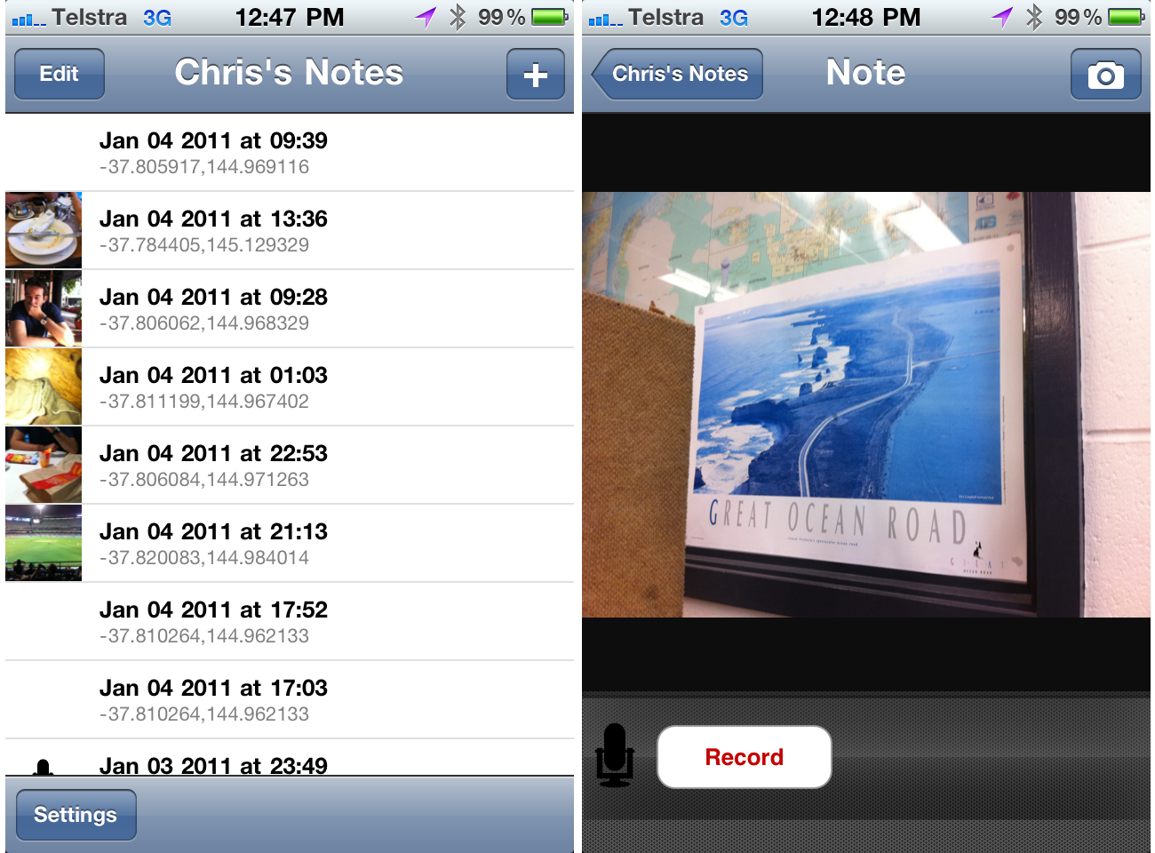
The dairy study was run using Evernote on a set of iPhone 3GS’s. Six rangers at Wilson’s Promontory were asked to participate, and their roles were carefully chosen in relation to their level of experience in the park, their typical duties, and the length of time they had spent in the park. I met with each participant in person to talk them through the use of the application, and to set up the expectations for the study. I also left a cheat sheet with them, detailing some “entry inspirations” that doubled as guidance on the types of entries I was looking for.

Download the cheat sheet I gave participants.

As you’d expect, we did some practice entries in our kick-off session, and I was careful to voice the usual reassuarances: there’s no right or wrong; even what you think is boring is interesting to me, etc.

Using Evernote was beneficial in a lot of ways. Originally I had planned on making my own diary study tool, and whilst Reuben and I managed to produce a working prototype, we abondoned it due to the difficulty in synching the data. Evernote’s built in web service was fantastic during the study as I was able to monitor entries in real-time. Each of the phones had a data allowance, and Evernote was set to automatically upload new entries as they were made. At the end of each day I would check what had been entered by each participant, and this was a great way of monitoring progress.

Feedback and encouragement was typically sent every 1 or 2 days via SMS to the study phone, and I have no doubt that this had a positive effect on the outcome of the study. In total, there were over 90 geo-tagged and time-stamped entries comprising of audio, video and photography – a very rich account of what had happened during and around the flood recovery.


Revealing personal geographies

Rather than thinking of the Park as a single geographical space, it can be thought of as a combination of different productions of space, including individuals unique interpretations of it. This implies that what is defined as a “park” is a multilayered entity that is constructed out of a number of different perspectives. This ‘relational’ notion of a space is grounded in cultural geography, but has recently begun to appear in human-computer interaction and design generally.

By asking people to carry the phone with them, it revealed the importance people placed on certain locations in the park; it helped reveal a participant’s subjective experience of the park. Each participant’s collection of diary entries provided one slice out of many that contribute to the Park’s overall meaningfulness. This ‘slice’ is what I’m defining as a personal geography here.

It showed/created a narrative for each participant as they moved through the flood recovery – their personal geography showed how certain areas in the park loomed large for them. By recording their movements and thoughts, it gave insight into their park, whilst also providing an enduring record of the historical event of the flood.

Evernote’s API allowed me to plot out their movements throughout the study period, but also to augment those movements with recorded media. These narratives formed a type of qualitative map – a “personal geography” that represents the relationship between that person and the park, during a particularly severe natural event.  You can see some very basic results from this is older blog posts.


Forming Histories

The goal of the study was to gain an insight into the daily practices of park rangers. As such, participants were asked to talk about details of their days they went about it. Unsurprisingly then, most entries were topical and timely to the day they were recorded; they were about difficulties encountered, conversations had or in some cases, were even notes to the participant themself for a later time. However, a number of entries were reflective and interpretive in nature.

What this highlighted was that certain staff desired a platform to share an interpretation of places filtered through their experience. They were reflecting on locations in-situ, and when asked to talk about those places, they began interpreting them in relation to current and past events and their own experiences working within them – particularly reflecting on what had changed over time. They were recording a history of that place that was tinged with their own lived experiences of it: the diary study (end evernote) were their platform, and the place itself was a tool for reflection.

A picture that was used to supplement an oral history

Most of these reflective entries were oral in nature, however they were supported by photos in some cases. What the diary study provided participants with  was a platform for constructing oral histories. They were providing new knowledge about and insights into the past through an individual biographical account, and these accounts represented an interplay between the past and present, the individual and the social. Boiled down to its essence, what rangers were doing was performing an act of memory.

So, inadvertantly, by giving rangers a tool to report about their day, what actually occured was something deeper: it acted as a prototype of a system that allowed them to construct histories.

Research methods as systems prototyping

This surprising use was evident all through my research, not just with the diary study. More on that another time – I wanted to write this here to highlight (first) that Evernote is a fantastic tool for conducting mobile diary studies, and (second) that clever incorporation of technology in the design of your research (as very different to interface design!), can provide you insights and inspirations for future designs of actual systems.

Follow the thing

Eight months after the flood at Wilson’s Promontory, Tidal River has been (kind of) re-opened to the public. People are able to stay in the park itself (fortunately, this includes researchers), but many of the surrounding trails are still in need of repair.

Status update aside: I spent two days in the park this week conducting interviews with staff. The interviews consisted of two parts: using the diary entries from a previous study as probes in interviews, to dig in to what the life of these media objects might be within the organisation; and an examination of the “personal geography” of the park, for each interviewee. This was elicited through drawings of the park – more about these in another post.

Entries as probes

I just want to give a brief summary and background on one of the methods I used in the interviews. The entry-as-probe section is a basic attempt at “following-the-thing” (Marcus, 1995) – an ethnographic method for tracking digital and media based objects across multiple sites, in order to discover their role in social processes and contexts. The key phrase here is multiple sites; despite my study area being a geographical location, its focus is on the social and organisational contexts around this location. It is not investigating what happens in the cartesian representation of the park (i.e. what you see on a traditional map), but what happens in a broader social context in order to manage that area. Without getting too sidetracked on writing about my actual thesis: it’s important to investigate the flow of information and people that make park management possible. Marcus’s method boosts the status of an “object” (in this case, a dairy entry) to an equal actor in the construction of meaning, rather than a tool to be used by people as they themselves do the construction. As such I want to investigate the potential role of these created “media” objects in the ability to trigger different interpretations for people in varying roles across the organisation.

The next step in following-the-thing is the city office. Taking entries from the park and putting them in front of people unfamiliar with it will hopefully provide some interesting insights into the different understandings they have about Wilson’s Prom.

This is all in attempt to examine the different geographies that exists within Parks Victoria. The differences between the park and the city will be a key one, I’m predicting.


Reference:

Marcus, G. (1995). JSTOR: Annual Review of Anthropology, Vol. 24 (1995), pp. 95-117. Annual review of anthropology.


Geographies of access

Following on from the last post on an analysis of the movement of rangers, I’d like to discuss another interesting (if not obvious) finding from the diary study. That is: that accessibility dictates what is possible to know.

Access and infrastructure are common topics in ubiquitous computing literature – access to “digital space” is dependant on infrastructure that supports it: a wifi signal, 3G telecommunications towers, an internet cafe. Similarly, infrastructure can dictate the ways we navigate a space – we might choose a cafe to eat at depending on the likelihood of an internet connection; less “digitally” focused, the car route we choose to one destination depends on the roads that exist, but then also our knowledge of the likely traffic conditions of those roads. In each case: access to infrastructure (and the quality of that access) influences our behaviour.

This isn’t as obvious in the image I generated for the previous post, but after doing a lazy google map of the data the trend is clear: almost all entries were made on or near a road. Even those taken “off road” were generally not far from it – judging from conversations with rangers, these places are generally within walking (or equipment-carrying) distance of their vehicles. Also, the few outliers visible on the map are taken along walking tracks, rather than roads. The volume of recordings on a place depends on the bandwidth of the access. Roads are high bandwidth, walking tracks less so – dense scrub: very low.

Some questions that this raises:

  1. How can you design for discovery of “new” knowledge when data-rich areas are also, by necessity, the most familiar?
  2. What opportunities will there be for technology to encourage exploration of new areas?
  3. How will existing infrastructure and accessibility to the park limit the potential for exploration?

Thick Description

This week I finally received my ethics approval. For those who haven’t had to deal with an university ethics committee before, it’s a notoriously lengthy and tedious process. I managed to have my research methods approved within 3 months, which is about half the time it took my research partner – so understandably, I’m pretty happy!

As part of the ethics submission I essentially planned out every stage of the hands-on research I’ll be conducting with park rangers. I’m relying heavily on qualitative methods to uncover the behaviour, goals and habits of park rangers as they go about their jobs – focusing on who they communicate with, what information they impart and use, what decisions they make, and how all of this related to their notion of location. Essentially, I’m treating park rangers as a community with their own set of practices, and, through qualitative research, am hoping to uncover deeper links between themselves and the spaces they manage.

Thick description

A key aspect of almost all qualitative research is the notion of “thick description” – a term that appears in just about every text book on the subject. However despite it’s seeming importance, it’s a notoriously difficult concept to define. There have been numerous attempts, as documented in Joseph Ponterotto’s paper from 2006 (reference below).

In 1973, Geertz was the first to use the term in relation to qualitative research, and states the following:

From one point of view, that of the textbook, doing ethnography is establishing rapport, selecting informants, transcribing texts, taking genealogies, mapping fields, keeping a diary, and so on. But it is not these things, techniques and received procedures that define the enterprise. What defines it is the kind of intellectual effort it is: an elaborate venture in, to borrow a notion from Gilbert Ryle, “thick description”.

Denzin (1989) attempts to define thick description by comparing it to “thin description”. According to Denzin, thick description has the following features:

“(1) It gives the context of an act; (2) it states the intentions and meanings that organize the action; (3) it traces the evolution and development of the act; (4) it presents the action as a text that can then be interpreted. A thin description simply reports facts, independent of intentions or the circumstances that surround an action. (p. 33)”

Other definitions essentially equate it to doing ethnography – in that, the actual nature of ethnography is to gather thick descriptions. This is the most common link between the definitions – essentially, like ethnography as a practice, “thick description” can be said to provide context and meaning to observed actions, rather than simply recording the occurrence of an event in isolation. It’s more about recording the story of a fact, rather than the fact itself.

There are a number of ways to achieve the type of data that might be defined as “thick” – participant interviews, field observations, analysis of personal spaces and artifacts, and more. Diary studies are another well documented form, as part of a broader notion of a “cultural probe”. This is one which I intend to use with park rangers.

There’s an app for that

Thick Description

To this end, and given the extra-special role that location plays in my research, Reuben and I have built a custom application for park rangers, that asks them to provide thick descriptions of the locations they manage.

The application is mobile based (iOS specifically), and relies on a combination of GPS, photography and audio descriptions to gain a subjective sense of the spaces and places rangers make decisions about.

Each entry into this diary app is time-stamped and can be any combination of coordinate, photo and audio description. It’s this combination of audio and visual input that is the most powerful – given the nature of a park rangers job, audio descriptions are the most effective means of capturing the actions of rangers, and one that matches their current behaviour more closely than text based descriptions.

The goal is to create a low barrier to entry for rangers wanting to talk about their jobs as they’re doing them. Rangers will then be allowed to self-categorise/tag entries ex situ, before being visualised and used as discussion points in follow-up interviews.

The above screenshots are from the first functional version of the app, with many more improvements (particular design) to come.

Focusing the diary

To help guide the use of this application, we’re providing rangers with a set of guidelines on what types of information and input we’re interested in. Broadly, we’d like them to capture their interactions with other rangers, the decisions they make, the information they use in making these decisions. Given the role of location in all of these research questions, their entries will be analysed and visualised on maps to allow them to comment on the relationship between themselves and their environment.

We want to make this a fun activity for rangers, and we’ll be conducting kick-off sessions, and I will be following rangers into the field regularly to make my own observations and hopefully help overcome any confusion about the study before rangers are left alone with the application.

Wrap up

Thick description is a key part of the qualitative research I will be conducting with rangers at Wilson’s Promontory national park – I hope to uncover deep relationships between the rangers themselves and the locations they manage. As part of a much wider research program, we’ve designed and implemented a location-based diary study tool that will allow us to conduct remote research to be used as probes for further interviews.

Next for us is to build a visualisation interface for all this data – one that will allow us as researchers a way of making sense of qualitative data about locations, but one that will hopefully provide the basis of a knowledge management tool for Parks Victoria themselves.

References

Please note that the links below are to purchase the references I use in this post on Amazon. If you do find them interesting and decide to purchase them, I collect a small commission. Doing so will help support this blog (and my research!) in a small way, and I will be very grateful!