This is an archival copy of my PhD blog, which was active between 2009–2015. I'm publishing it again as a personal time capsule, but also because I think it's an interesting documentation of the PhD process itself, which might be useful to someone, somewhere. – Chris Marmo, January 2026

OZCHI Presentation: Location and Context

On Friday I gave a presentation in one of the last sessions at OZCHI in Brisbane, Australia. It covered some familiar topics that I’ve presented on before, but also contained new elements of what location as context might mean.

The paper is available in the OZCHI proceedings, and I’ll upload a version here once I get access to a decent internet connection.

Emerging Standards: OpenGEO & The POI

There’s so much happening in the “location” space it’s easy to discount it as a buzzword. It doesn’t help that the phrase “Location Based Service” gets misused in ways that severely limit it’s scope – I’m looking at you, plethora of check-in apps.

But, location and, more so, context-awareness are the real deal, and as our understandings of them evolve we’re going to see more formal structures and guidelines for their use – particularly for developers and service designers.

The OpenGEO group are leading the way in developing standards for use in location services. By providing a set of common and desirable system attributes they not only provide guidelines for new applications and services, but also give us a criteria to assess existing ones. If you call yourself a location-based-service, you’re probably doing much of what they suggest anyway. However, it’s still worth checking out. Just in case.

Once you’ve got your head around those and are interested in getting in on the ground floor of a similar but complimentary initiative, you might want to check out the recently launched W3C POI Working Group.

From their charter:

The objective of the POI WG is to develop a Recommendation that defines a POI data format that allows digital content publishers to effectively describe and efficiently serve points of interest data.

That is, they’re working on describing exactly how points should be defined, and how they could be transmitted.

In other news…

There appeared to be lots of interesting stuff presented at the International Symposium on Mixed and Augmented Reality conference in Korea, and RMIT’s own Matthew Kwan has developed geoSMS: a standard for sending your location via SMS.

Next: a quick breather after conference paper submissions before starting on some interesting new work.

Space vs Place: The next step in context-awareness

The idea of context-awareness has been gaining a lot of attention recently, and it’s driven largely by the fact that the required technology has become affordable and reliable enough to bother. “Location” though, as a raw GPS coordinate, is not enough. Here’s my take on what’s after this sensor-based revolution, taken from a recently submitted conference paper:

Read more

Park life

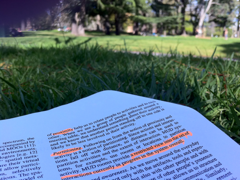
The first weekend of sunshine has brought everyone and their frisbee out, and I’m enjoying the best of both worlds armed with a highlighter and a backpack for a pillow. What better place to think about context-awareness in parks than in a park?

The beginnings of paris

I’m currently knee-deep in another conference paper – this one to be submitted to ICA Conference in Paris, 2011. If accepted I’ll be heading there in July. That’s the bread-stick of motivation currently being dangled in front of my buret-adorned and stripey shirted self.

To be honest, even without the Eiffel Tower looming, I’d still be reading and writing about this right now as context-awareness has captured my imagination. I’m working towards a first draft of the paper today and over the weekend, but I thought I’d post the introduction here for feedback on its direction.

Read more

GeoCart’2010 Presentation

Today I gave a talk about the role of GeoVisualisation in making sense of location based information at GeoCart’2010 in Auckland, New Zealand. It was well received and I got some tough questions from the audience afterwards – always a good sign.

I’ll post a link to the paper I wrote a bit later on, but hopefully the slides are fairly self explanatory!

Location is not enough

Progressing on from my previous post regarding the subjective nature of locations in a National Park (i.e. that rangers view places differently from each other and that their views may also change over time), I have written something in the conclusion of my OZCHI paper that I think hits the nail on the head. Location is not enough – location is just a coordinate. The question is, how can you infer the context that exists between a location and the person? Why is that person in a place and what are they hoping to do there?

Here’s the part from the paper. If you’d like the references mentioned just let me know:

Geovisualisation is an important tool that assists in the analysis and discovery of information amongst the plethora of location-based data we now have ready access to. The act of visualising data is repaid exponentially in terms of cognitive savings (Larkin & Simon, 1987), and can lead to the formation of deeper and better quality understanding about a problem domain (Lowe and Bouchiex, 2008).

However, the subjective, social nature of knowledge does highlight the importance of people in the ecology of sense-making and knowledge discovery – it is important not only to understand how people will interact with geo-visualisation interfaces, but also how they go about generating and absorbing knowledge from their existing social structures; that is, how they share and communicate with each other.

Any intelligent interface designed to meet the needs of the current research project should not only be concerned with the display of location-based data, but it should also be aware of the social and environmental contexts in which it is being used.

Subsequently, it is not enough that data being displayed be tagged with a location in the form of GPS coordinates. From a machine and computational perspective this is the necessary first step towards providing information about a place, but from a human-interaction perspective the display and dissemination of this data needs additional context. Simply: a person may be in the same location for entirely different purposes, and an intelligent location-based service needs to be aware of this purpose.

Geovisualisations are an important tool for the sense and decision-making processes, but it is the role of the holistic design of a system (that includes geovisualisation) to infer a better quality understanding of the goals and motivations of a user based on their location. It is hoped that further research in this project will provide insights into how location can be augmented with this further context, and how geovisualisation can assist users to explore this.

I think I’ve latched on to a new take on the project, but I need to do more reading into ubicomp and context-awareness to get a better understanding of what work has already been done in this space.

Any suggestions? Thoughts? Thanks!

OZCHI ’10

I’m submitting a short paper to the OZCHI ’10 conference held in Brisbane, Australia. Here’s the abstract put together with the help of my supervisors:

The proliferation of consumer electronics devices that are Global Positioning System (GPS)- enabled has led to an increase in the availability and quantity of data that is geo-located. The position of where certain data has been captured, photographs taken, or places visited can be easily and quickly appended to files generated by a portable device. Related to the capture of information and the subsequent geo-coding has been the need to visualise this data.

Geovisualisation, the viewing of geographical data and representations of geography (maps) through the frame of location, has become an important method for sense-making and knowledge discovery. Recent research in this relatively new field has positioned it as being more akin to “geovisual analytics”, with an emphasis on the cognitive elements of exploration of data through highly interactive interfaces rather than a simple static display. This repositioning highlights the importance of the human elements of interaction with geo-based data and the interfaces designed to present them. How should interaction be guided by the role of location? How can interfaces provide information to users that is place-specific or location ‘bounded?

In an attempt to provide a background to the benefits of geovisual analytics, this paper will explore the role that perception has in complex problem solving and knowledge discovery. It will demonstrate that, through the use of modern interactive technologies, (geo)visualisations can augment and facilitate our natural ability to see novel, surprising and otherwise invisible relationships between information. As well, it will discuss a current research project that is developing concepts that will be implemented to assist in the management of natural environments – specifically in a national parks setting. It will also demonstrate the application of this research in a broader project that is being conducted with Parks Victoria, around national park management – particularly, fire management and prevention.

it still needs a bit of tweaking, but I’d be keen to hear your thoughts!

Location as context

Our second informal visit to our study area involved a couple of in-depth conversations with park rangers and a tour of the admin facilities at Tidal River, the main hub of operations at Wilson’s Prom. It was more a visit to keep in touch with our project partners at Parks Victoria, but there were still some very useful findings that went along with the stunning scenery.

Read more